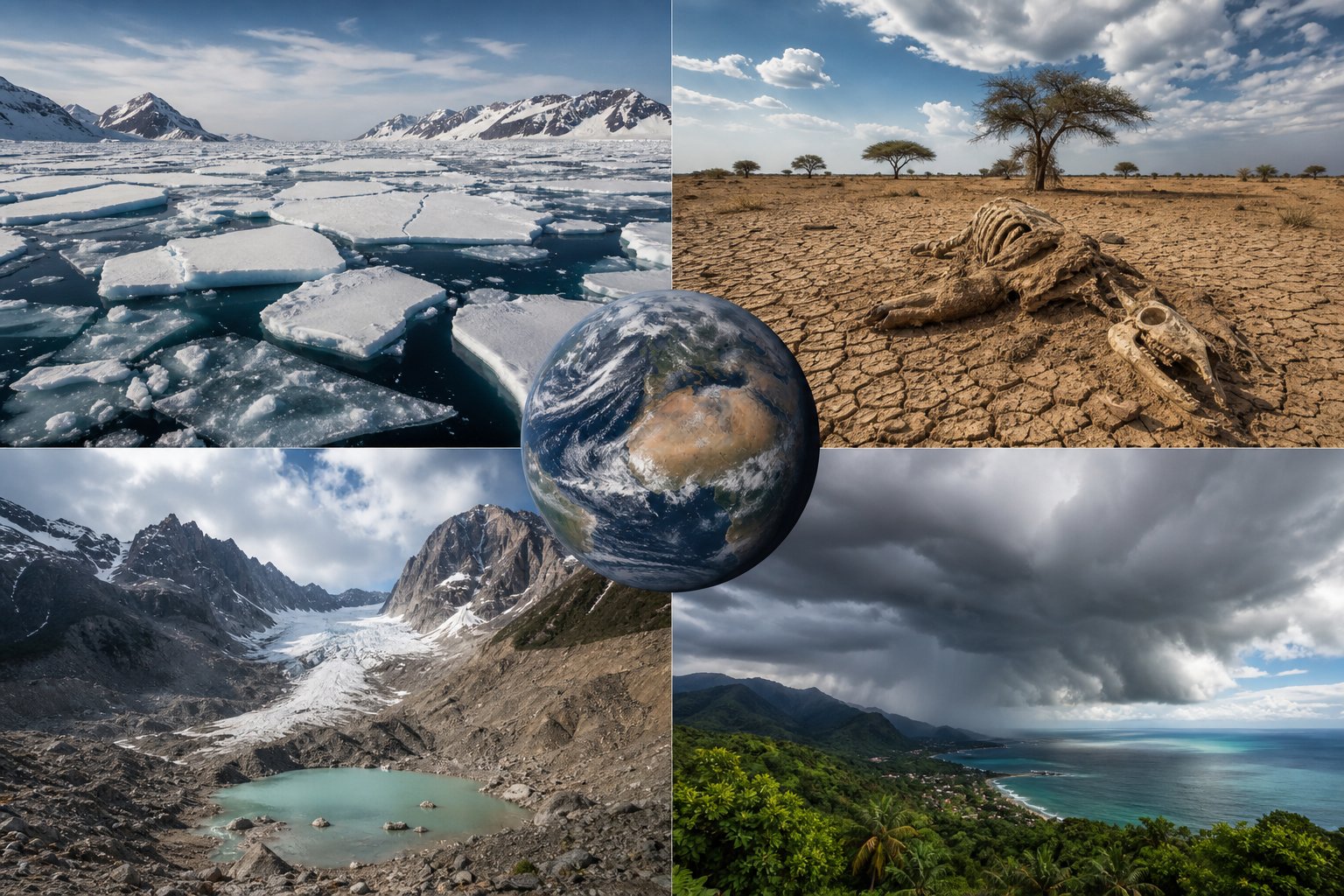
Regions Where Weather Changes: 7 Critical Planetary Shifts in Global Climate Patterns, Polar Amplification, and Regional Vulnerability
The global climate system does not respond to rising atmospheric temperatures in a uniform or predictable manner. Investigating specific regions where weather changes are accelerating reveals an intricate planetary patchwork of intensified hydrological extremes, rapid glacial retreats, expanding arid zones, and shifting oceanic teleconnections. For decades, popular discourse surrounding global warming presented climate shifts as a gradual, universal increase in average air temperatures; however, empirical atmospheric research conducted by institutions like the University Corporation for Atmospheric Research (UCAR) and the Intergovernmental Panel on Climate Change (IPCC) paints a far more nuanced reality. While high-latitude polar zones warm at up to four times the global rate—a phenomenon known as polar amplification—sub-tropical and equatorial belts face unprecedented agricultural drought, and high-altitude mountain headwaters lose natural seasonal water storage. Understanding the distinct dynamics governing these regional climatic transitions is essential for preparing agriculture, coastal infrastructure, and public health systems for the century ahead.
The Unequal Planetary Balance: Why Regional Climates Respond Differently
To understand why weather changes vary drastically between continents, one must examine the fundamental thermodynamic and geographic mechanisms governing Earth’s atmospheric circulation.
1. Land-Sea Thermal Inertia and Latitude Asymmetries
The physical properties of landmasses versus oceans create fundamental regional temperature divergence:
- Specific Heat Capacity: Water possesses a substantially higher specific heat capacity than terrestrial soil and rock. Consequently, continental land interiors warm significantly faster than adjacent ocean basins, driving intense regional heatwaves across North America, Europe, and Central Asia.
- The Clausius-Clapeyron Relation: For every 1°C increase in atmospheric temperature, air can hold approximately 7% more water vapor. In moist tropical and temperate zones, this thermal law fuels supercharged atmospheric rivers and catastrophic deluge events; in contrast, over arid landmasses, enhanced evaporation desiccates surface soils and depletes ground moisture.
2. Global Atmospheric Circulation Cells
Planetary wind systems dictate the geographic distribution of precipitation:
- The Expansion of Hadley Cells: Tropical atmospheric circulation belts are expanding poleward, pushing the dry, subtropical high-pressure ridges further into temperate latitudes.
- Shifting Jet Streams: Uneven warming weakens the north-south temperature gradient between the Arctic and the equator, causing the polar jet stream to meander in slow, undulating Rossby waves that lock extreme weather patterns—such as prolonged heat domes or stubborn polar vortices—over specific regions for weeks.
Polar Regions: The Epicenter of Arctic Amplification
The Arctic and portions of Antarctica represent the fastest-warming environments on Earth, functioning as sensitive early-warning barometers for the global climate system.
The Ice-Albedo Positive Feedback Loop
The retreat of polar sea ice triggers a self-reinforcing thermodynamic cycle:
- Loss of Planetary Reflectivity: Fresh snow and thick multi-year sea ice reflect up to 85% of incoming solar radiation back into space. As rising ocean temperatures melt sea ice, it exposes dark open water, which absorbs over 90% of solar radiation.
- Year-Round Thermal Absorption: This absorbed thermal energy delays winter sea ice freeze-up, elevates baseline air temperatures, and alters hemispheric pressure systems. Current scientific models project ice-free Arctic summer conditions before the middle of the twenty-first century.
Greenland and Antarctic Ice Sheet Destabilization
- Continental Melt Dynamics: In Greenland and West Antarctica, continental ice sheets holding trillions of tons of freshwater are discharging into the ocean at accelerating rates through melting surface meltwater lakes and oceanic basal melting of floating ice shelves.
- Ocean Thermohaline Circulation Impacts: Massive infusions of buoyant, low-density freshwater into the North Atlantic threaten to disrupt the Atlantic Meridional Overturning Circulation (AMOC), which regulates northwestern Europe’s mild climate.
Regional Climate Impact and Vulnerability Matrix
| Geographic Region | Primary Weather / Climate Driver | Dominant Vulnerabilities | Ecosystem & Human Health Impacts | Projected 2050 Outlook |
|---|---|---|---|---|
| The Arctic & High Latitudes | Polar amplification, albedo loss | Sea ice loss, permafrost thaw | Coastal erosion, methane release, infrastructure collapse | Ice-free summer oceans, altered jet stream |
| High Mountain Ranges | Cryosphere melt, isotherm elevation | Glacial retreat, early spring runoff | Glacial lake outbursts, downstream summer freshwater scarcity | Depleted long-term river headwaters |
| Sub-Saharan Africa & Sahel | Expanding Hadley cells, rainfall drops | Severe agrarian drought, soil drying | Crop failure, livestock loss, critical water-borne illness | 75 to 250 million vulnerable to water stress |
| South & East Asian Monsoons | Altered sea surface thermal gradients | Extreme erratic monsoon deluges | Catastrophic riverine flooding, urban drainage failure | Intensified monsoon rainfall and longer dry spells |
| Pacific Rim & El Niño Basins | ENSO teleconnections, marine heatwaves | Intensified droughts and flash floods | Coral reef bleaching, fisheries collapse, cyclone volatility | More frequent extreme El Niño / La Niña events |
| Mediterranean & Sub-Tropics | Polar jet migration, subtropical ridge | Desertification, prolonged heatwaves | Catastrophic wildfires, loss of olive/vineyard agriculture | Transitioning into semi-arid climate zones |
High Mountain Water Towers: Disappearing Glacial Reserves
High-altitude mountain systems—such as the Himalayas, the European Alps, the South American Andes, and the Rocky Mountains—act as the world’s primary natural freshwater storage towers.
1. The Shrinking Snowpack and Seasonal Timing Disconnect
Mountain ecosystems rely on seasonal freezing and thawing:
- The Snow-to-Rain Transition: Warmer winter temperatures cause precipitation to fall as rain rather than snow at higher elevations, preventing the accumulation of dense seasonal snowpack.
- Rapid Spring Runoff: Snow melts weeks earlier in the spring, triggering severe early-season river flooding while leaving riverbeds parched during hot summer months when agricultural irrigation demand peaks.
2. Downstream Freshwater Scarcity and Glacial Lake Outbursts
- Downstream Civilizations: Billions of people across South Asia and South America rely on river basins fed by glacial melt (such as the Indus, Ganges, Yangtze, and Amazon headwaters) for drinking water, sanitation, and hydroelectric power.
- Glacial Lake Outburst Floods (GLOFs): As glaciers rapidly retreat, massive volumes of meltwater collect behind unstable moraine dams. Sudden moraine collapses release catastrophic flash floods that sweep through downstream mountain villages.
Equatorial and Sub-Tropical Belts: Intensified Droughts and Food Security
While polar and high-latitude areas experience increased total precipitation, many equatorial and mid-latitude regions face devastating declines in available freshwater.
1. Vulnerability in Sub-Saharan Africa and the Sahel
The humanitarian impact of changing regional weather is felt most acutely across the African continent:
- Agricultural Fragility: Between 75 and 250 million people across East, West, and Central Africa are projected to experience critical water stress and chronic drought conditions.
- Agrarian Collapse: Because the vast majority of regional agriculture relies strictly on rain-fed crop cycles, shifting rainfall seasons and scorching heatwaves decimate staple crops like maize, millet, and sorghum, driving severe food insecurity.
2. Desertification in the Mediterranean Basin
- Northward Aridity: The Mediterranean region—spanning Southern Europe, North Africa, and the Middle East—is warming 20% faster than the global average.
- Forest Fire Vulnerability: Drier soils and extended summer droughts fuel catastrophic, uncontrollable wildfire seasons across Greece, Italy, Spain, and Portugal, converting centuries-old Mediterranean woodlands into arid scrublands.
Monsoonal Regions and Extreme Oceanic Teleconnections
Weather changes in coastal and oceanic territories are heavily influenced by complex coupled ocean-atmosphere oscillations.
1. El Niño Southern Oscillation (ENSO) and Oceanic Heatwaves
The periodic warming (El Niño) and cooling (La Niña) of the equatorial Pacific Ocean generate atmospheric shockwaves across the globe:
- Global Teleconnections: A strong El Niño alters storm tracks worldwide, triggering intense flooding across coastal Peru and California while inducing severe droughts and bushfires across Australia, Indonesia, and Southern Africa.
- Coral Reef Bleaching: Marine heatwaves associated with shifting oceanic oscillations trigger mass bleaching events across the Great Barrier Reef and the Coral Triangle, unraveling the marine ecosystems that sustain coastal fishing economies.
2. Erratic Monsoon Dynamics Across South Asia
- Concentrated Precipitation: Rising sea temperatures across the Indian Ocean disrupt historical summer monsoon cycles. Rather than steady, nourishing rainfall distributed evenly across four months, the region increasingly experiences long dry spells punctuated by violent, multi-day cloudbursts that overwhelm civil infrastructure and submerge major agricultural plains.
Public Health Impacts Across Vulnerable Latitudes
The geographical reorganization of weather patterns brings profound public health consequences that disproportionately affect developing nations.
1. Vector-Borne Disease Expansion
Warmer, wetter conditions expand the geographical habitats of disease-carrying insects:
- Dengue and Malaria Shifts: The Aedes aegypti mosquito, which transmits dengue fever, Zika, and chikungunya, is expanding into previously temperate regions across the southern United States, Southern Europe, and higher-altitude African cities.
- Tick-Borne Encephalitis and Lyme Disease: Blacklegged ticks are migrating into high-latitude Canadian provinces and northern Scandinavia as shorter, milder winters fail to suppress tick populations.
2. Water-Borne Pathogens and Extreme Flow Fluctuations
- Stagnation and Contamination: During severe drought cycles, sluggish river flows allow bacterial pathogens such as Vibrio cholerae to thrive in stagnant drinking supplies.
- Floodwater Sewage Infiltration: Conversely, extreme flash flooding overwhelms urban municipal sewer systems, contaminating municipal wells and triggering acute gastroenteritis outbreaks across vulnerable populations.
Frequently Asked Questions About Regional Weather Changes
Why are polar regions warming faster than the rest of the planet?
Due to Arctic amplification, melting reflective white sea ice exposes dark open ocean water, which absorbs more solar heat and accelerates local atmospheric warming in a self-reinforcing feedback loop.
Which global regions are most vulnerable to freshwater shortages?
Sub-Saharan Africa, the Mediterranean basin, parts of Central and South Asia, and downstream valleys reliant on glacial snowpacks face the most critical water scarcity risks.
How does climate change alter high-altitude mountain environments?
Warmer temperatures cause precipitation to fall as rain instead of snow, trigger earlier spring runoffs, accelerate glacial melting, and raise the risk of catastrophic glacial lake outburst floods.
What is the connection between a warming climate and the jet stream?
A reduced temperature difference between the Arctic and the equator weakens the polar jet stream, causing it to meander and lock prolonged heatwaves, droughts, or polar freeze events over specific regions.
How do changing regional weather patterns impact global food production?
Extended droughts in breadbasket regions like the Sahel, American Midwest, and Mediterranean reduce crop yields, while sudden unseasonal flooding washes away topsoil and damages agricultural infrastructure.
How are disease-carrying mosquitoes affected by shifting weather?
Higher temperatures and altered rainfall patterns expand suitable breeding habitats for mosquitoes, spreading vector-borne illnesses like dengue fever and malaria into higher latitudes and elevations.
Conclusion
The planetary reality of modern atmospheric science reveals that climate disruption does not unfold uniformly, but through distinct, localized fractures across specific regions where weather changes most aggressively. From the rapid loss of Arctic sea ice and the depletion of vital mountain glaciers to expanding agricultural droughts across Africa and erratic monsoon cloudbursts over Asia, different latitudes face fundamentally unique survival challenges. Recognizing that global temperature averages mask acute regional vulnerabilities is the essential first step toward effective climate adaptation. Building climate-resilient water infrastructure, re-engineering agricultural practices for extreme drought and deluge cycles, and fortifying coastal defenses will dictate how successfully human societies navigate the shifting environmental map of the twenty-first century.







2 Comments